In episode six of our online exhibition "Ingenious inventions – Innovative ideas", on 22 March, World Water Day, we're following the trail of Roman aqueducts.
“Water is best”
With these words begins Pindar’s First Olympian Ode from the 5th century BC. Water was also indispensible for the people of the ancient world. Clean water was important and prized. Water was a “chief requisite for life, for happiness, and for everyday use,” wrote Vitruvius in the second half of the 1st century BC in his Ten Books on Architecture (8.1.1., transl. M. H. Morgan). If a settlement lacked clean, good quality drinking water, then water would have to be brought there. Hence one of the most important applications of ancient technological knowledge, inventions and technical calculations was in the transportation, lifting and distribution of water. The Romans were particularly proud of their aqueducts. It is not surprising that Frontinus – supervisor of the aqueducts of the city of Rome at the turn of the 1st and 2nd centuries – considered them more important than all earlier human inventions. “With such an array of indispensable structures carrying so many waters, compare, if you will, the idle Pyramids or the impractical, though famous, works of the Greeks!” (Sextus Julius Frontinus, The Aqueducts of Rome 16, transl. C. E. Bennett)
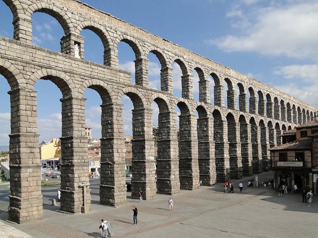
The Segovia aqueduct (photo by: Bernard Gagnon, en.wikipedia.org)
Light at the end of the tunnel
While people today tend to think of ancient aqueducts as bridge-like structures supported by piers, most aqueducts actually ran underground. Their construction, however, required no less technical experience and careful execution, deservedly drawing the admiration of contemporaries.
In Jerusalem an aqueduct was built around 700 BC, which is recorded in several places by the Old Testament. “Hezekiah also stopped the upper watercourse of Gihon, and brought it straight down to the west side of the city of David” (2 Chronicles 32.30; King James Version). The tunnel was dug from both ends, and where the two teams met an inscription was engraved in the rock celebrating their success.
The first aqueduct-building ‘engineer’ known by name was Eupalinus. Commissioned by the tyrant Polycrates, he had a tunnel for water dug through a mountain on the island of Samos in the 6th century BC; a feat of ancient technology. Herodotus described it as one of the greatest examples of engineering in all of ancient Greece, and also recorded the name of its builder.
Romans usually built underground aqueducts using stones or bricks. They laid the foundations, lining the bottom of the construction trench with rubble stone and covering it with sand and gravel. On this they built the walls of the aqueduct. The bottom of the conduit was covered with mortar. The floor and the walls were lined with a carefully smoothed layer of terrazzo, a mix of mortar and crushed brick. The conduit was then vaulted over, or sealed using slabs of stone or ceramic tiles. The longest aqueduct which ran underground for almost the entirety of its course was the Eifel Aqueduct, which brought water from a distance of 100 km to ancient Colonia Claudia Ara Agrippinensium (modern-day Cologne).
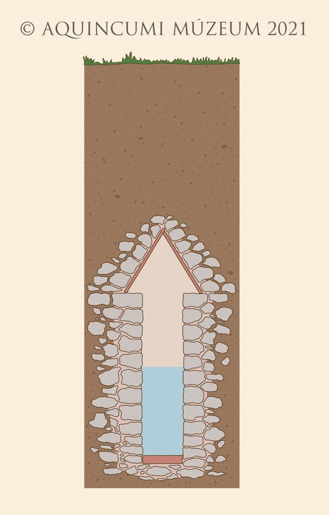
Cross-section of the aqueduct in Sopron (drawn by Tamás Lajtos after the drawing of Miksa Stornó)
“If we only take into consideration the abundant supply of water to the public, for baths, ponds, canals, household purposes, gardens, places in the suburbs, and country-houses; and then reflect upon the distances that are traversed, the arches that have been constructed, the mountains that have been pierced, the valleys that have been levelled, we must of necessity admit that there is nothing to be found more worthy of our admiration throughout the whole world.”
(Pliny Natural History 36.121–123, transl. J. Bostock and H. T. Riley)
Ancient aqueducts usually relied on gravity. They carried the water from a spring or a cluster of springs which lay at a higher altitude, along a course with a slight downward gradient, to the point of use. There were also closed pressurised pipe systems which used the principle of communicating vessels. These were, however, used only where necessary, e.g. for crossing deep valleys and for water distribution within the towns.
Aqueduct ‘bridges’ were built for two reasons. The first was when they needed to cross a deep valley (e.g. the famous Pont du Gard aqueduct). The second was when the land through which the water flowed to the town was flat; in that case the conduit was lifted onto piers to ensure the height required for water distribution. Examples of this include the aqueducts entering Rome, or the famous aqueduct of Segovia. Also belonging to this group, though on a much humbler scale, is the Aquincum aqueduct.
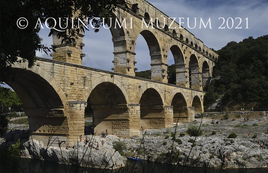
The Pont du Gard (photo by: Pál Kis)
The aqueduct of Aquincum
In amply-watered Aquincum, the Romans were in a fortunate position. They found good quality springs nearby, from which they could bring water to the legionary fortress as well as the Civil and Military Town. The most important role in the water supply was played by the springs at what is now the Római Lido. This was the starting point of the north-south aqueduct, the remains of which can be seen along modern-day Római Way and Szentendrei Road.
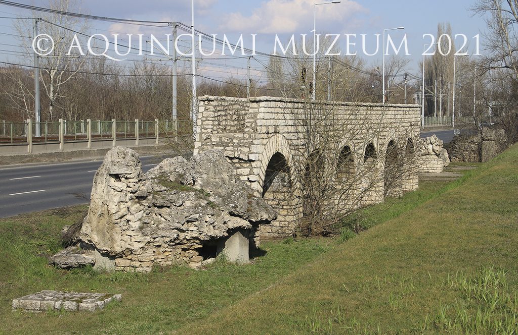
A reconstructed section of the Aquincum aqueduct with the remains of travertine blocks (photo by Péter Komjáthy)
Excavations have shown that where the Lido’s pools are now located, there used to be at least 15 or 16 timber spring houses, in which the water from the springs was collected in ceramic catch basins. At the top, there was a small settling basin, from which the water flowed into a conduit running on the surface. These conduits fed the water from the spring houses into the main channel. The spring houses had not just a practical purpose; the Romans, after all, venerated clean water. Hence they set up altars to their gods at the spring catchments, and threw coins, valuables and figurines of deities as offering into the spring houses and spring catch basins. There were likely also two temples by the springs, as well as a third building, used as a hospital or an inn
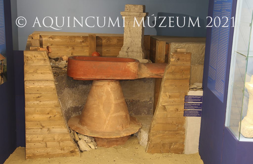
Exhibition interior presenting the spring houses excavated at Római Lido, with original and reconstructed artefacts. From the “Ingenious inventions – Innovative ideas” exhibition (photo by Nóra Szilágyi)
From the spring houses at the Római Lido a main channel on the surface carried the water south. The water then flowed into a settling basin presumably located at what is now the Római Campsite, where its level was slightly raised. From this basin the water was fed into the aqueduct. The aqueduct began its course on a gentle hill 107 m above sea level. It then continued in a 3-metre-tall arcade through a terrain around 104 m above sea level. The channel was likely carried on an arcade along almost the entirety of its course. The piers stood 3 metres apart on foundations dug into subsoil, which was marshy and soggy in many places. The aquaeductus, like other Roman aqueducts, was likely a gravity-flow aqueduct, covered with stone slabs. It had a slight, 0.9‰ gradient, and ran in a straight line until the legionary fortress at modern-day Flórián Square.
Animated video of the first leg of the north-south aqueduct in Aquincum (by Zsolt Fodor)
The aqueduct crossed the northern wall of the Civil Town west of the northern gate, it ran down the middle of the town and exited west of the southern gate. In the 3rd century, it was flanked on either side by an alley, 2.5-3 metres wide. The other side of the alleys was marked by the rear walls of surrounding buildings. There were three points for crossing the aqueduct: at the north side of the forum, at the main east-west thoroughfare, and in the southern part of the town at the street leading to the baths in the western half of town. Although the aqueduct primarily served the legionary fortress, in this period water was also channelled to the baths, public fountains and perhaps private home of the Civil Town as well.
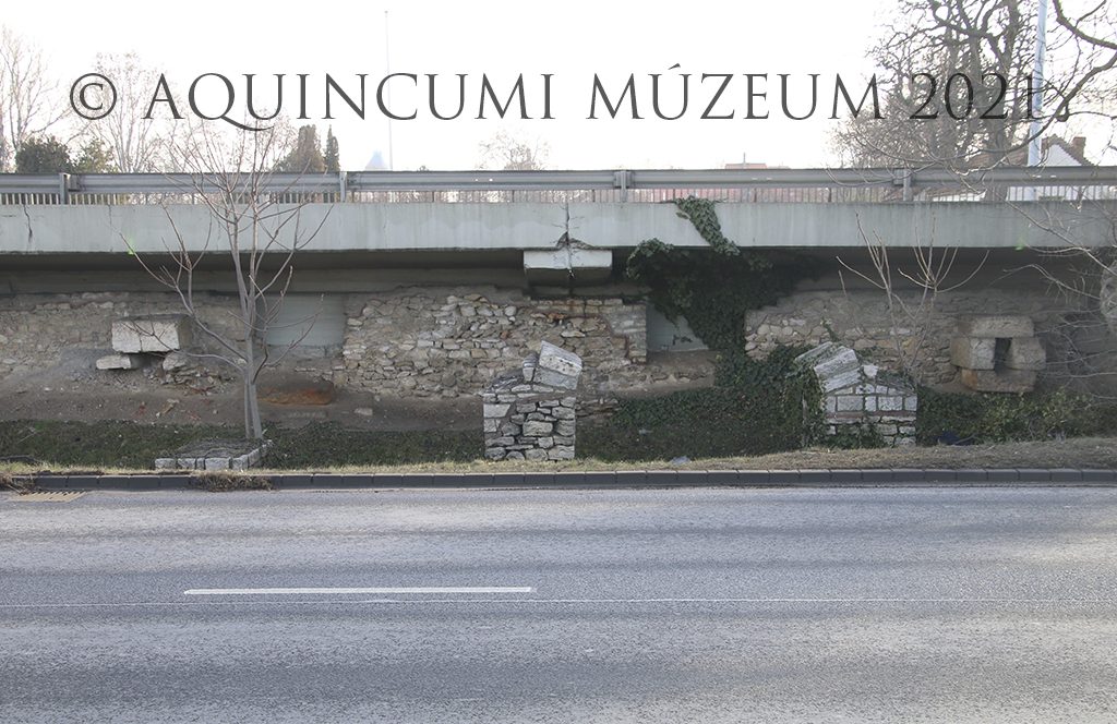
The remains of the aqueduct with the rear wall of the row of shops and the stone structures for pipes branching off the aqueduct (photo by Péter Komjáthy)
The last part of the aqueduct which we can still see today is the so-called Mária Rock. The rock is one of the huge limescale blocks formed over centuries by rainwater and water leaking from the aqueduct. It takes its name from an icon of the Virgin Mary, seized by the 1811 flood of the Danube, and rescued by an Óbuda stonemason by the name of Jakab Bauer, who affixed the icon to the large block. In antiquity the aqueduct ran further. For a time, it was hypothesised that the aqueduct continued until the military amphitheatre at Nagyszombat Street, which would have meant a length of up to 4.9 km. This is not supported either by archaeological evidence or Roman aqueduct-building customs. It is more likely that the aqueduct ran until or just north of, the legionary fortress’s northern walls, where it terminated in a large distribution tank (“water tower”). From there the water was brought to the users by an internal distribution network. Based on our current understanding, the length of the aqueduct was presumably between 3300 and 3400 metres.
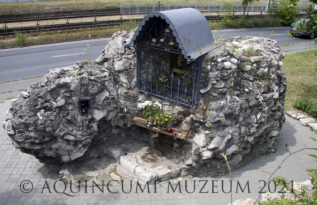
The Mária Rock (photo by Péter Komjáthy)
Written by Dr Gabriella Fényes
Click here to read the other entries of our online exhibition.


